
Automatic Implementation of Secure Silicon (AISS)

The Automatic Implementation of Secure Silicon (AISS) program aims to ease the burden of developing secure chips. AISS seeks to create a novel, automated chip design flow that will allow security mechanisms to scale consistently with the goals of a chip design. The target design flow will provide a means of rapidly evaluating architectural alternatives that best address the required design and security metrics, as well as varying cost models to optimize the economics versus security trade-off. The target system on chip (SoC) will be automatically generated, integrated, and optimized, and will consist of two partitions – an application specific processor partition and a security partition implementing the on-chip security features. By bringing greater automation to the chip design process, the burden of security inclusion can be profoundly decreased.
 Real Time depth map generation using SSD algorithm on low end Basys 3 FPGA. Support 320x240 and 160x120 resolutions. Most of the image processing projects in academia has been done on higher-end FPGA’s with a considerable amount of resources. The main objective of this project is to implement a reliable embedded system on a lower end FPGA with limited resources. This project is based on Disparity calculation based on SAD (Sum of Absolute Difference) algorithm and creating a depth map.

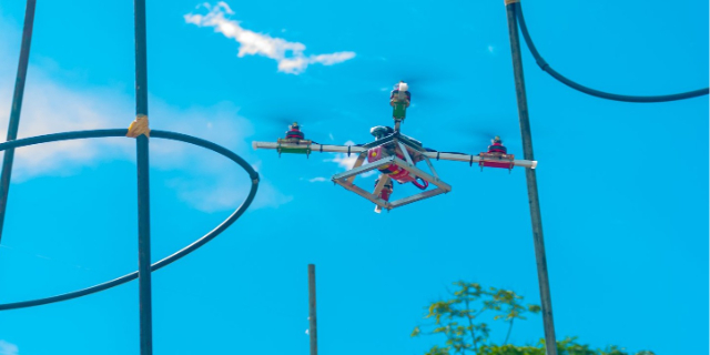 Design files of the simple heavy lifting drone created for Drone enduarance race Sky of Icarus. The robustness of a quadcopter frame is of paramount importance in ensuring its durability and reliable performance. A well-designed and sturdy frame is built to withstand the rigors of flight, including impacts, vibrations, and other external forces. It is typically constructed from high-quality materials such as carbon fiber or aluminum, which provide excellent strength-to-weight ratios. The frame’s design incorporates reinforcement at critical stress points, such as motor mounts and landing gear attachments, to distribute forces evenly and prevent structural failure.
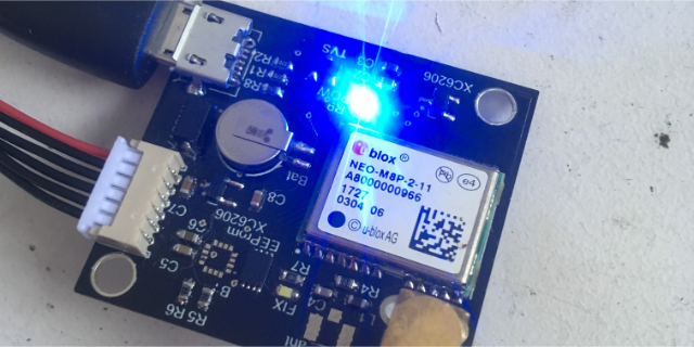 Real-Time Kinematics (RTK) GPS is a precise positioning technology that enhances the accuracy of standard GPS systems by utilizing additional information from reference stations. Traditional GPS receivers provide location information with an accuracy ranging from a few meters to several tens of meters. However, RTK GPS offers centimeter-level accuracy by employing a base station that continuously collects data from satellites and transmits correction signals to the rover receiver in real time. These correction signals compensate for atmospheric delays and other error sources, allowing the rover to calculate its position with exceptional precision. RTK GPS finds applications in various industries, including surveying, precision agriculture, construction, and autonomous navigation. Its high accuracy and real-time capabilities enable tasks such as land surveying, machine guidance, and UAV navigation with unparalleled precision, revolutionizing industries that require precise positioning information.